Interstate 10

I-10 Deck Park Tunnel in Phoenix dedicated to late ADOT engineer

I-10 Deck Park Tunnel in Phoenix dedicated to late ADOT engineer

I-17 101 traffic interchange

I-10 Deck Park Tunnel in Phoenix dedicated to late ADOT engineer

I-10 Deck Park Tunnel in Phoenix dedicated to late ADOT engineer

May 7, 2024

Dean Lindsey managed implementation of I-10’s ‘Final Mile’ in the 1980s

PHOENIX – The Arizona Department of Transportation is honoring a late civil engineer tasked with managing the development of the Interstate 10 Deck Park Tunnel and final segments of the Papago Freeway north of downtown Phoenix.

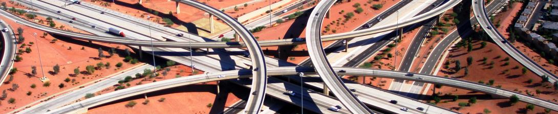
On Tuesday, May 7, ADOT Director Jennifer Toth, former ADOT Director and U.S. Secretary of Transportation Mary Peters and others dedicated the I-10 tunnel in Dean Lindsey’s name with signs outside each tunnel entrance and a plaque in Margaret T. Hance Park. Lindsey guided development of the interstate’s downtown-area segments, including the tunnel, in the 1970s and ’80s. The Deck Park Tunnel, which was part of the “Final Mile” of I-10 across the country, opened to traffic in August 1990. 

ADOT officials, former colleagues and others joined Lindsey’s family in the park, located above the tunnel through which well over 250,000 vehicles pass daily, to unveil a plaque reading “Dean Lindsey I-10 Memorial Tunnel.” The work included close collaboration with the city of Phoenix and the community on the complex development of the tunnel and the city’s Margaret T. Hance Park. 

“Dean Lindsey had a reputation for bringing people together during the design work that allowed I-10 and Hance Park to become realities in the downtown Phoenix area more than 30 years ago,” Director Toth said. “He was a key architect of the early Valley freeway program, and I’m sure he’d want to share this dedication with those who worked beside him.”

That sentiment was shared by a one-time colleague, retired ADOT Chief Deputy State Engineer Bob Mickelson. 

“You can’t overstate the work that Dean put into the Papago Freeway,” Mickelson said. “There were times he was working seven days a week. He was wonderful with people, which was important at a time when planning that section of I-10 was politically charged. He was the right man to lead the planning and design processes for the tunnel project, the I-17 Stack interchange and the I-10 connections with State Route 51.” 

Lindsey began working for ADOT in 1974. He also spent time working in the consultant engineering sector. His daughter Laura Felten summed up her father’s legacy this way:

“Dad loved his work at ADOT and looked back on it with pride. He had many stories about the accomplishments, the camaraderie with coworkers and the problem solving required to deliver projects. Whenever our family drives through the Deck Park Tunnel, we call it ‘PaPa’s Tunnel.’ We are so honored that it now bears his name.” 

Lindsey retired from ADOT in 2006 and passed away in 2023. He was honored with an Arizona Transportation Legacy Award in 2014 during the 63rd Conference on Roads and Streets held in Tucson. The Arizona State Board on Geographic and Historic Names is the official state body that approved naming the tunnel in Dean Lindsey’s honor.  


Expect heavier traffic toward Glendale for Tuesday’s Stones concert

Expect heavier traffic toward Glendale for Tuesday’s Stones concert

I-17 101 traffic interchange

Expect heavier traffic toward Glendale for Tuesday’s Stones concert

Expect heavier traffic toward Glendale for Tuesday’s Stones concert

May 6, 2024

Time is on your side if make an earlier start toward State Farm Stadium

PHOENIX – Consider making an early start toward State Farm Stadium if you’re planning to spend Tuesday night together with tens of thousands of other Rolling Stones fans. 

With the concert scheduled for 8 p.m. and doors opening at 6 p.m., heavier traffic is likely all down the line on westbound Interstate 10 in Phoenix and on Loop 101 (Agua Fria Freeway) in Glendale as concertgoers join the usual crowd goin’ home. ADOT encourages all drivers to allow extra time and avoid acting like wild horses. We have sympathy for you. 

The situation needn’t ruin your Ruby Tuesday or leave you shattered, however. Those who gotta get away from the Chandler/southeast Valley area might actually get some satisfaction by using westbound/northbound Loop 202 (South Mountain Freeway) to bypass I-10 through downtown Phoenix. Parking lots open at 4 p.m., so if you make an earlier start you just might wind up hanging fire while waiting on a friend who didn’t heed this advice. You can tell them, “Miss you.” 

You can get the real-time lowdown on highway conditions on ADOT’s Arizona Traveler Information site at az511.gov or by calling 511. ADOT also shines a light via its Twitter/X feed, @ArizonaDOT.

Jan. 23 virtual meeting set for I-10/Jackrabbit Trail improvements

Jan. 23 virtual meeting set for I-10/Jackrabbit Trail improvements

I-17 101 traffic interchange

Jan. 23 virtual meeting set for I-10/Jackrabbit Trail improvements

Jan. 23 virtual meeting set for I-10/Jackrabbit Trail improvements

January 10, 2024

ADOT seeks public input about planned interchange reconstruction

PHOENIX – The Arizona Department of Transportation will hold a virtual public meeting on Tuesday, Jan. 23, to provide information, gather comments and answer questions about designs to improve the Interstate 10 interchange at Jackrabbit Trail in the Buckeye area.

ADOT’s virtual meeting is scheduled as follows:

  • 6 to 7:30 p.m., Tuesday, Jan. 23 
  • Participants can register online at azdot.gov/JackrabbitMtg
  • You also can use the call in number: 669.444.9171 Participant ID: 264911
  • English Webinar ID: 951 5167 6868  Spanish Webinar ID: 948 3052 6118

Planned improvements include:

  • Reconstructing the I-10/Jackrabbit Trail interchange and adding traffic signals.
  • Widening on- and off-ramps and providing additional turn lanes.
  • Widening Jackrabbit Trail to three lanes in each direction between McDowell Road and Van Buren Street.

The project to improve traffic flow and safety at the Jackrabbit Trail interchange is not currently funded for construction. This project is included in the Regional Strategic Transportation Infrastructure Investment Plan.

The virtual meeting will include a presentation by ADOT’s project team and an opportunity for questions and comments from participants. Following the meeting the presentation will be available on the project’s study website at azdot.gov/I10Jackrabbit.

Public comments about the draft recommended improvements at I-10 and Jackrabbit Trail can be submitted through Feb. 7 in the following ways: An online survey at azdot.gov/i10JackrabbitComments; by phone at 623.695.7411; by mail at ADOT Community Relations, 1655 West Jackson St., MD 126F, Phoenix, AZ 85007 and by email at [email protected].


Busier commute on tap Friday before Cardinals preseason game

Busier commute on tap Friday before Cardinals preseason game

I-17 101 traffic interchange

Busier commute on tap Friday before Cardinals preseason game

Busier commute on tap Friday before Cardinals preseason game

August 8, 2023

Allow extra time and try to arrive early ahead of 7 p.m. kickoff (Friday, Aug. 11)

PHOENIX – Heavier traffic is likely on westbound Interstate 10 and Loop 101 (Agua Fria Freeway) in the West Valley on Friday afternoon, Aug. 11, prior to the preseason game between the Arizona Cardinals and Denver Broncos, according to the Arizona Department of Transportation.

Fans heading to State Farm Stadium in Glendale should allow extra time and try to arrive early. Stadium parking lots will open at 3 p.m. Kickoff is scheduled for 7 p.m.

Those traveling from the Chandler/southeast Valley region should consider using westbound/northbound Loop 202 (South Mountain Freeway) to bypass I-10 in the downtown Phoenix area. 

Crews working for Glendale will be prepared to close Loop 101 on- or off-ramps near the stadium at times as part of the city’s plan to enhance traffic flow before and after the game.

Fans also should practice patience after leaving the stadium and be prepared for heavier freeway traffic along sections of Loop 101 and I-10 in the West Valley. 

Real-time highway conditions are available on ADOT’s Arizona Traveler Information site at az511.gov or by calling 511. ADOT also provides information and updates via its Twitter feed, @ArizonaDOT


Eastbound I-10 to close between SR 51 and US 60

Eastbound I-10 to close between SR 51 and US 60

I-17 101 traffic interchange

Eastbound I-10 to close between SR 51 and US 60

Eastbound I-10 to close between SR 51 and US 60

June 14, 2023

Drivers should expect delays and plan for detours

PHOENIX –  The Arizona Department of Transportation is advising motorists to plan ahead and expect to use detours as eastbound Interstate 10 will be closed between SR 51 and US 60 from 10 p.m. Friday, June 16, to 4 a.m. Monday, June 19, for bridge work and a traffic shift. During this closure, the following ramps will be closed. 

  • Eastbound I-10 on-ramps at Third, Seventh and Jefferson streets, Buckeye Road, 24th, 32nd and 40th streets and Broadway Road
  • The loop ramp from southbound SR 143 to eastbound I-10
  • Southbound I-17 on-ramps at Seventh Avenue and Seventh Street
  • The ramp from southbound I-17 to eastbound I-10
  • The westbound Loop 202 (Red Mountain Freeway) ramp to eastbound I-10
  • The southbound SR 51 on-ramp at McDowell Road
  • The ramps from southbound SR 51 to eastbound I-10 
  • The high-occupancy vehicle (HOV) ramp from eastbound I-10 to eastbound Loop 202 (Red Mountain Freeway)

Detour: Use eastbound Loop 202 (Red Mountain Freeway) to southbound Loop 101 (Price Freeway) to westbound US 60 or Loop 202 (Santan Freeway) to access eastbound I-10 beyond the closure. Drivers traveling on southbound I-17 can use westbound I-10 to eastbound Loop 202 (Red Mountain Freeway).

West Valley drivers heading to the Southeast Valley can bypass the closure by using the Loop 202 (South Mountain Freeway). From I-10 and 59th Avenue, travel south and east to connect with I-10 south of Chandler Boulevard.

Please note: Schedules can quickly change because of weather and other unforeseen situations. For the most up-to-date information, we encourage you to download the Interstate 10 Broadway Curve Improvement Project’s free mobile app, The Curve, or visit the Alerts section of the project website before you travel.

                                                                                                                ###

The I-10 Broadway Curve Improvement Project is identified in the Maricopa Association of Governments’ Regional Transportation Plan, funded by a half-cent sales tax approved by Maricopa County voters in 2004 through Proposition 400. MAG identified the need for this project to reduce travel times on I-10 during peak hours; improve airport access; support ridesharing and transit; and prepare the region for future growth projections. Learn more about the major improvements here


ADOT opens new Interstate 10 lanes in West Valley

ADOT opens new Interstate 10 lanes in West Valley

I-17 101 traffic interchange

ADOT opens new Interstate 10 lanes in West Valley

ADOT opens new Interstate 10 lanes in West Valley

June 1, 2023

Project has added third lanes between Verrado Way and SR 85

PHOENIX – A busy 8-mile stretch of Interstate 10 in the West Valley has been widened to three lanes in both directions as an Arizona Department of Transportation freeway improvement project moves into the homestretch.

ADOT’s ongoing $82 million project has widened I-10 by one lane in both directions between Verrado Way and State Route 85. The new lanes are designed to improve safety and overall traffic flow for local drivers in Buckeye and motorists on longer trips in or out of the West Valley.

Weeknight and weekend lane restrictions are still planned while crews take care of final work on the project over the next several weeks. Construction on the two-year project started in July 2021.

In addition to the new lanes, I-10: SR 85 to Verrado Way Improvements is constructing new freeway bridges and reconstructing ramps connecting I-10 with SR 85. Crews also modernized the interchanges at Watson and Miller roads by rebuilding them using the diverging diamond design.

The I-10 project in Buckeye is part of the Maricopa Association of Governments’ Regional Transportation Plan. It is funded in part by Prop 400, a dedicated sales tax for transportation improvements approved by Maricopa County voters in 2004.


Quick work safely restored I-10 traffic after crash damaged bridge

Quick work safely restored I-10 traffic after crash damaged bridge

I-17 101 traffic interchange

Quick work safely restored I-10 traffic after crash damaged bridge

Quick work safely restored I-10 traffic after crash damaged bridge

May 5, 2023

ADOT, contractor worked around the clock to shore up overpass near Willcox

WILLCOX – Arizona’s interstate freeways are essential corridors for personal and commercial travel. When an incident forces an extended closure, the Arizona Department of Transportation responds quickly to reopen the thoroughfare as soon as possible with safety the No. 1 goal. 

That’s what happened after a fatal semi-tractor trailer crash early Wednesday caused significant damage to the support structure of the US 191 bridge over westbound Interstate 10 just west of Willcox. Less than two days later, an ADOT project reopened the westbound lanes with a temporary support of steel members.

“I am proud of our ADOT team members and dedicated contractors who quickly identified and executed this emergency project,” ADOT Director Jennifer Toth said. “They safely set up detours, got the necessary team in place and worked around the clock to reopen this key corridor in less than two days.” 

Approved by ADOT’s Bridge Group, supervised by engineers in ADOT’s Southeast District and made possible by an emergency procurement, the project engaged Granite Construction Inc. as the prime contractor. Mere hours after the Arizona Department of Public Safety had completed its crash investigation, ADOT and the contractor began working nonstop to demolish the damaged bridge pier and erect the temporary support structure.

What the public can’t see when passing this temporary structure is the intensity of effort, the dedication and the commitment to safety that made it possible. 

A welder who was on site for nearly the entirety of the project told our engineers that he is 80 years old but still at it for his son’s company, which was a subcontractor. “I’ve retired six times but love what I do,” he said. 

Also generously assisting in this monumental effort were state, county and local law enforcement agencies that worked along the detour routes and southeastern Arizona counties and municipalities. The New Mexico Department of Transportation assisted with closing westbound I-10 in New Mexico. 

Now that a temporary structure is in place at the US 191 bridge at I-10 milepost 331, ADOT will determine a long-term plan. At a minimum, the pier, girders and deck where the crash occurred will likely need to be replaced.

There is never a good time for an extended closure, especially one that involves a lengthy detour from such a busy freeway. When it does happen, ADOT team members respond quickly and work as hard as possible with safety as their overriding goal. 

Temporary Structure

I-10 Diverging Diamond Interchange open at Watson Road in Buckeye

I-10 Diverging Diamond Interchange open at Watson Road in Buckeye

I-17 101 traffic interchange

I-10 Diverging Diamond Interchange open at Watson Road in Buckeye

I-10 Diverging Diamond Interchange open at Watson Road in Buckeye

April 27, 2023

ADOT opens second such interchange built during I-10 widening

PHOENIX – Drivers in the West Valley can now use the second I-10 Diverging Diamond Interchange (DDI) to be constructed as part of the Arizona Department of Transportation’s ongoing freeway widening project in the Buckeye area.

Crews reopened the I-10 interchange at Watson Road today (Thursday, April 27). The interchange has been reconstructed using the diverging diamond design, which has grown in popularity across the country for safety and traffic flow benefits.

Diverging diamonds allow the two directions of cross-street traffic traveling over or under a freeway to shift to the opposite side of the roadway. The crossing is designed to improve the overall movement of traffic and enhance safety by limiting potential traffic conflict points and allowing direct left turns onto a freeway entrance ramp. Drivers avoid waiting at a traffic signal and don’t cross in front of opposing traffic when making those left turns.

ADOT continues work to widen 8 miles of I-10 from two to three lanes in each direction between Verrado Way and State Route 85. The entire $82 million I-10 improvement project, which was launched in July 2021, is on schedule for completion this summer (2023).

The I-10/Watson Road interchange is the fourth full diverging diamond to be added along the state’s highway system. The nearby DDI at Miller Road opened in Aug. 2022 as part of the I-10 widening project. DDIs also have been constructed at I-17 and Happy Valley Road in north Phoenix and along I-10 at Houghton Road in the Tucson area. Two smaller diverging diamonds also are in use along the Loop 202 South Mountain Freeway in Phoenix.

ADOT works in partnership with the Maricopa Association of Governments on the planning and construction of new freeways, additional lanes and other improvements in the Phoenix area as part of the Regional Transportation Plan for the Maricopa County region. Projects are funded in part by Proposition 400, a dedicated sales tax approved by Maricopa County voters in 2004.

Eastbound Interstate 10 closed between State Route 51 and US 60 from Friday, Oct. 28 to Monday, Oct. 31

Eastbound Interstate 10 closed between State Route 51 and US 60 from Friday, Oct. 28 to Monday, Oct. 31

I-17 101 traffic interchange

Eastbound Interstate 10 closed between State Route 51 and US 60 from Friday, Oct. 28 to Monday, Oct. 31

Eastbound Interstate 10 closed between State Route 51 and US 60 from Friday, Oct. 28 to Monday, Oct. 31

October 26, 2022

PHOENIX- The Arizona Department of Transportation advises motorists to plan for delays and expect to use detours this weekend as eastbound Interstate 10 is closed between State Route 51 and US 60 from 10 p.m. Friday, Oct. 28, to 4 a.m. Monday, Oct. 31. Crews with the Interstate 10 Broadway Curve Improvement Project will continue bridge work this weekend. The following ramps will also be closed:

  • The eastbound I-10 on-ramps at Third, Seventh, and Jefferson streets, Buckeye Road, and 24th, 32nd, and 40th streets.
  • The loop ramp from southbound SR 143 to eastbound I-10.
  • The southbound I-17 on-ramps at Seventh Avenue and Seventh Street.  
  • The ramp from southbound I-17 to eastbound I-10.
  • The westbound Loop 202 (Red Mountain Freeway) ramp to eastbound I-10.
  • The southbound SR 51 on-ramp at McDowell Road
  • The ramps from southbound SR 51 to eastbound I-10. 
  • The HOV ramp from eastbound I-10 to eastbound Loop 202 (Red Mountain Freeway).

Detour: Use eastbound Loop 202 (Red Mountain Freeway) to southbound Loop 101 (Price Freeway) to westbound US 60 or westbound Loop 202 (Santan Freeway) to access eastbound I-10 beyond the closure. Drivers traveling on southbound I-17 can use westbound I-10 in the downtown Phoenix area to eastbound Loop 202 (Red Mountain Freeway). 

West Valley drivers heading to the Southeast Valley can bypass the closure by using Loop 202 (South Mountain Freeway). From I-10 and 59th Avenue, travel south and east to connect with I-10 south of Chandler Boulevard. 

To view images of the ongoing construction work for the I-10 Broadway Curve Improvement Project, visit the project Flickr album here.

Westbound I-10 will be narrowed to one lane at Guadalupe Road from 8:30 p.m. Sunday, Oct. 30, to 4 a.m. Monday, Oct. 31, for bridge work. Also, the westbound I-10 on-ramp at Elliot Road will be closed. Use the Warner Road on-ramp instead.

Please note: Schedules can quickly change because of weather and other unforeseen situations. For the most up-to-date information, we encourage you to download the Interstate 10 Broadway Curve Improvement Project’s free mobile app, TheCurve or visit the Alerts section of the project website before you travel.

# # #

The I-10 Broadway Curve Improvement Project is identified in the Maricopa Association of Governments’ Regional Transportation Plan, funded by a half-cent sales tax approved by Maricopa County voters in 2004 through Proposition 400. MAG identified the need for this project to reduce travel times on I-10 during peak hours; improve airport access; support ridesharing and transit; and prepare the region for future growth projections. Learn more about the major improvements here. 


ADOT statewide electric vehicle charger plan gets approval

ADOT statewide electric vehicle charger plan gets approval

I-17 101 traffic interchange

ADOT statewide electric vehicle charger plan gets approval

ADOT statewide electric vehicle charger plan gets approval

September 15, 2022

Arizona is one of the first states in the nation to have its Electric Vehicle Infrastructure Deployment Plan given the stamp of approval from the Federal Highway Administration. 

The Arizona Department of Transportation submitted its draft proposal in August and with the federal approval this week, $11.3 million will be made available immediately with another $16.3 million coming in October of this year to begin implementing the plan. This is a portion of the overall $76.5 million allocated for this program in Arizona over the next five years through the recently enacted federal Infrastructure Investment and Jobs Act (IIJA) /planning/infrastructure-investment-and-jobs-act

The next step for ADOT is to solicit and award the contracts to upgrade existing stations as well as develop new locations along designated alternative fuel corridors. Advertising for bids to upgrade existing stations will begin in spring of 2023 followed by bid solicitations in autumn 2023 for new construction. The plan calls for stations to be no more than 50 miles apart wherever possible. 

In many cases, stations will be located where there is already infrastructure in place, such as truck stops, roadside lodging, restaurants and shopping centers, among other possibilities. 

Currently, the alternative fuel corridors are identified as all six of the federal Interstate Highways throughout the state. These are Interstates 8, 10, 15, 17, 19, and 40 which account for more than 20 percent of all the vehicle miles traveled in Arizona. Other non-interstate corridors will be determined and included in the plan in future years. The plan will next be updated in August of 2023. 

Among the specific goals of the plan are reducing electric vehicle drivers’ “range anxiety” by closing gaps in the charging network along the designated corridors and ensuring the network is resilient, equitable, accessible and reliable. Also the plan aims to identify new charging locations as part of an ongoing public outreach process and will use data to evaluate the system and make improvements. 

A copy of the plan, more information, and contact information to leave feedback are available here: /planning/transportation-studies/arizona-electric-vehicle-program