Interstate 10/Koli Road Traffic Interchange Study
Interstate 10/Koli Road Traffic Interchange Study
*Previously known as the Interstate 10 (I-10) Germann Road Traffic Interchange Study
The Arizona Department of Transportation (ADOT), as the lead agency and project sponsor, in collaboration with the Gila River Indian Community (Community), the Bureau of Indian Affairs (BIA), the Federal Highway Administration and the Maricopa Association of Governments, has initiated a Design Concept Report (DCR) and an environmental study (assumed to be an Environmental Assessment or EA) for the proposed Interstate 10/Koli Road Traffic Interchange.
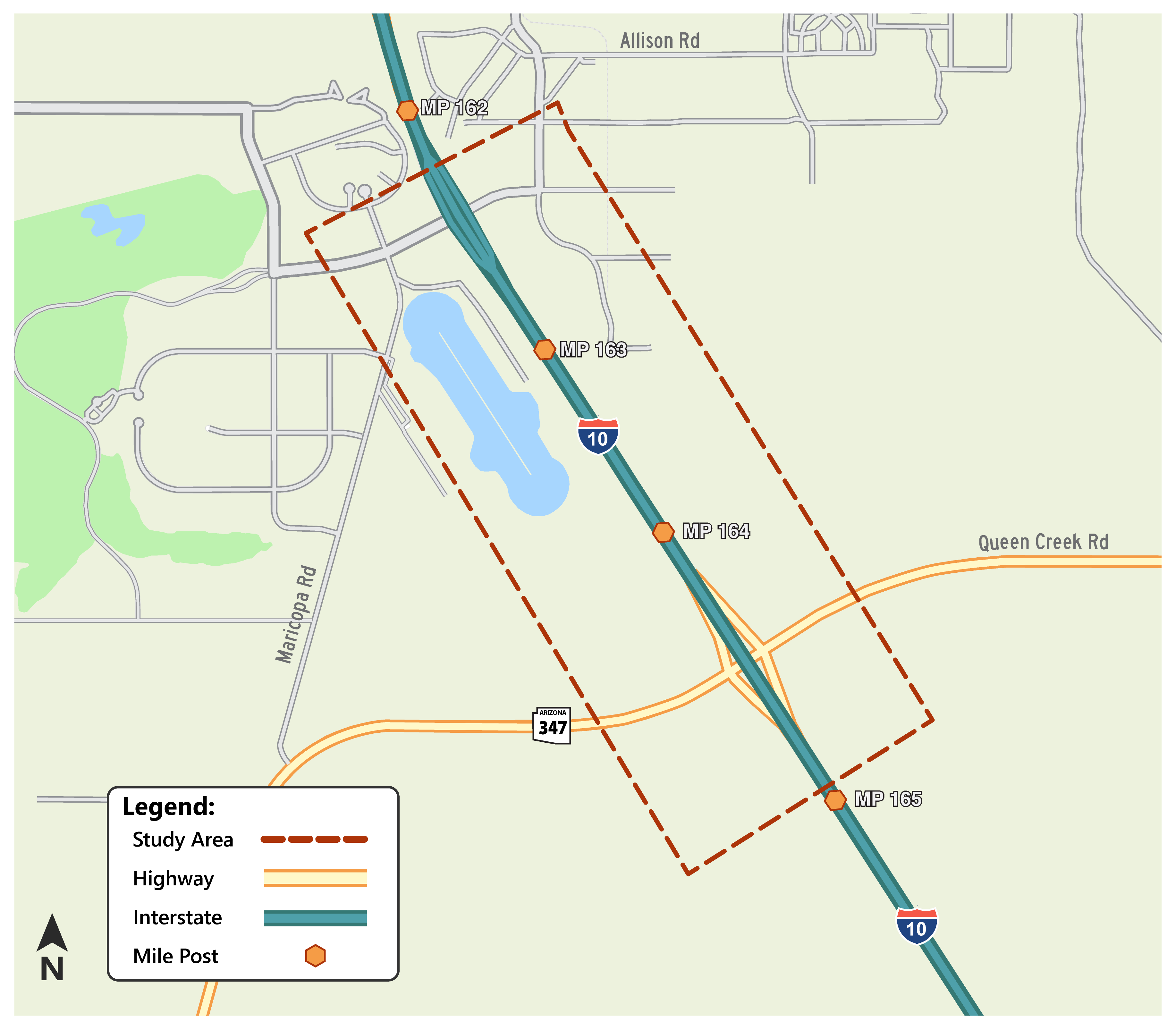
The proposed I-10/Koli Road Traffic Interchange would be located on I-10 between the existing Wild Horse Pass Boulevard and State Route 347/Queen Creek Road traffic interchanges.
The study area limits would extend approximately a half mile from each side of the I-10 center line and approximately three-quarters of a mile north of milepost 163 and 1.8 miles south of milepost 163 along I-10. The project is located in Maricopa County and entirely within the Gila River Indian Community.
The EA will consider and assess alternatives for the traffic interchange, including a no-build alternative. Some considerations to be analyzed in-depth in the EA will include the proposed project’s impacts on cultural resources, biological resources, water quality, recreational resources, noise impacts and air quality, as well as other social, economic, and environmental impacts.
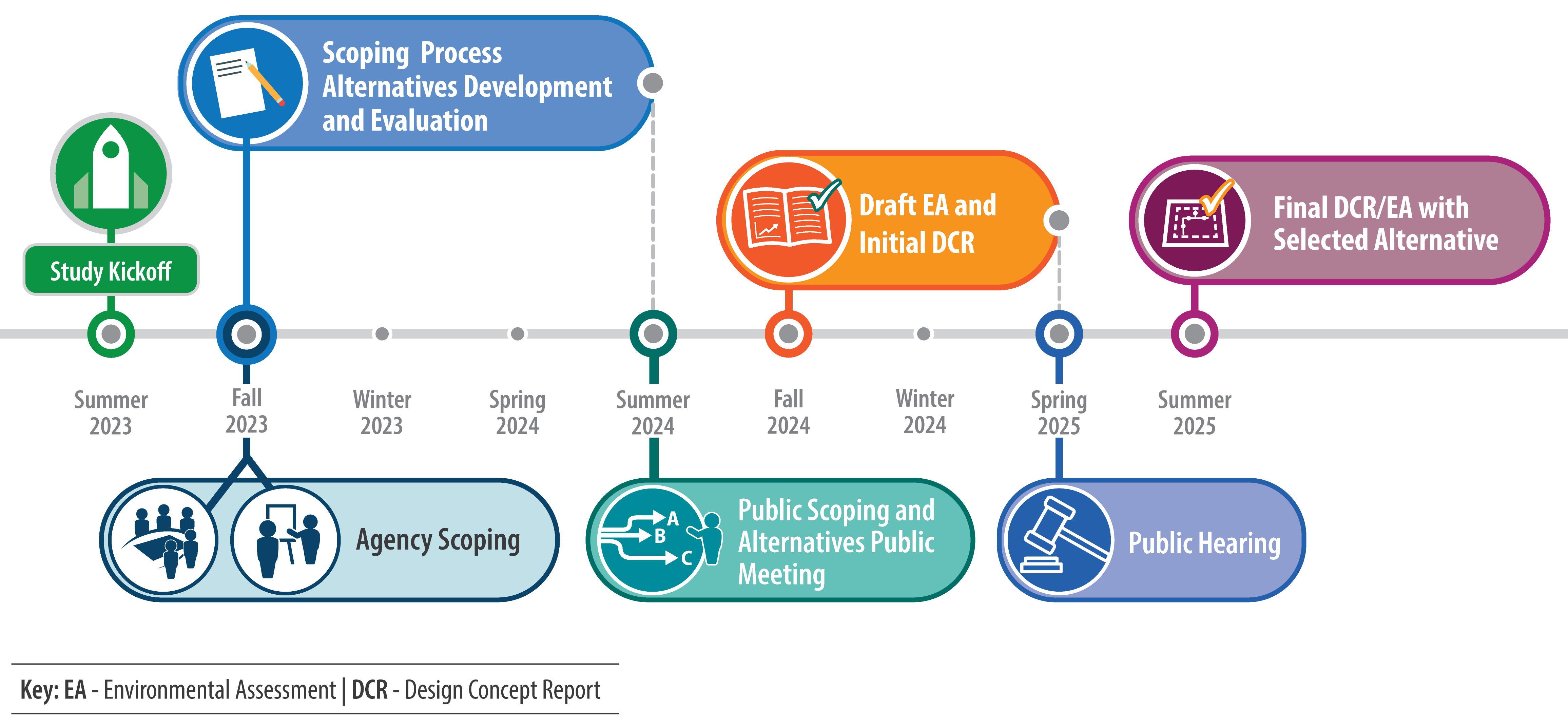
The Agency Scoping comment period closed on January 31, 2024. Thank you for submitting your comments.
General Inquiries
- Subscribe to receive project updates and traffic alerts.
- By phone: Call the ADOT Bilingual Project Information Line at 855.712.8530.
- By email: [email protected]
- Online: Visit azdot.gov/contact and select Projects from the drop-down menu.
Area Map
Timeline